 |
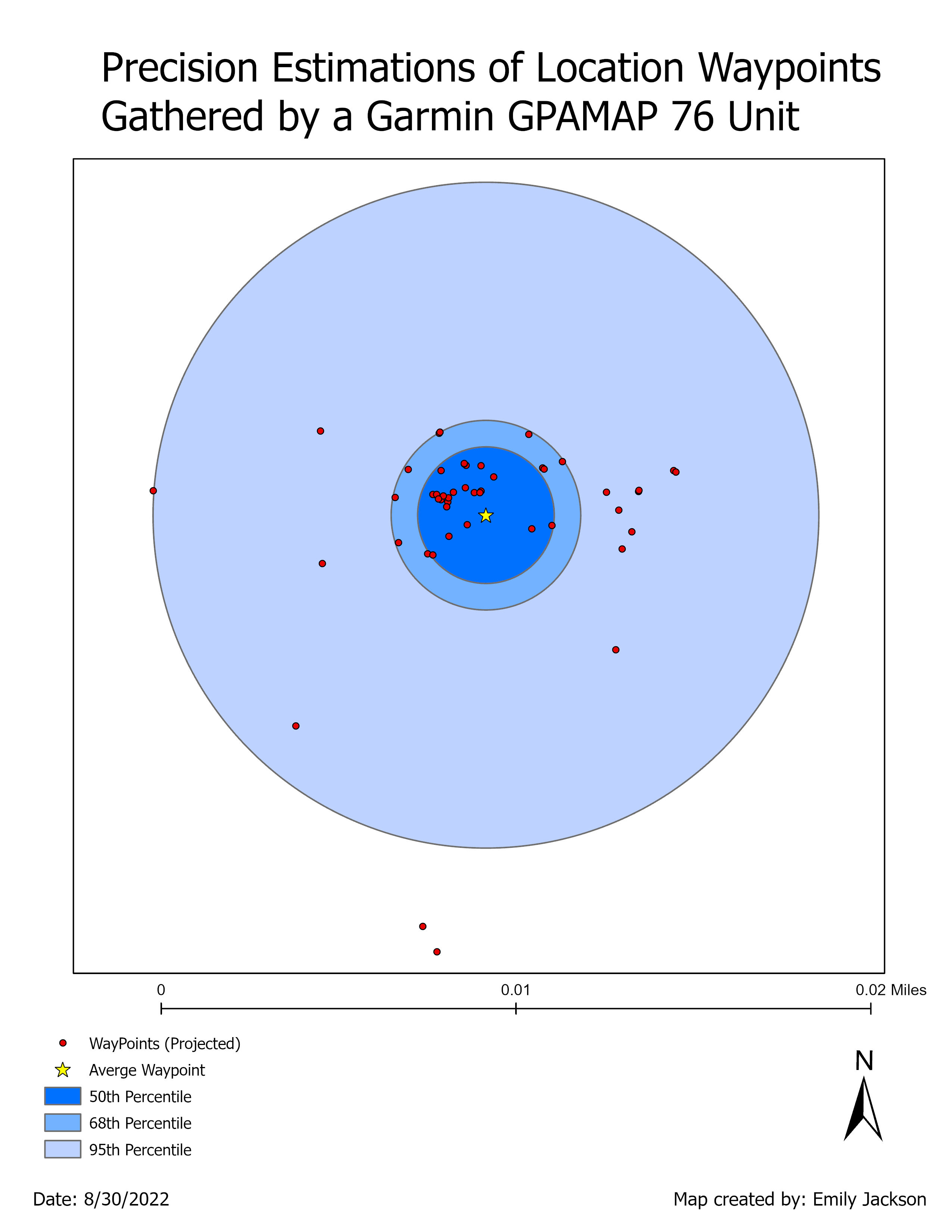
| The precision of waypoints mapped by the Garmin GPSMap 76. Blue buffers denote 50th, 68th, and 95th percentiles, the star is the calculated mean waypoint location. |
A primary tenant of mapping and analyzing data well is the ability to assess whether you are working with good data in the first place. For the first lab in Special Topics, we reviewed the fundamentals of data accuracy and precision, particularly in regard to the horizontal and vertical attributes often associated with GIS location data.
The dataset we worked with was 50 points taken several years ago around a single location by a Garmin GPSMap 76. Through basic geospatial and statistical analysis I determined the horizontal and vertical accuracy and precision for the dataset. A subset of those determinations are below:
Horizontal accuracy: 3.49 meters Horizontal precision: 4.3 meters
Horizontal accuracy is determined by comparing the waypoints to a known reference point. This is effectively a measurement of how far "off" from the actual xy point the mapping unit was recording locations. Horizontal precision however is a measurement of the range of values returned by the unit, and does not require the "actual" xy point because it is a comparison of waypoints to one another. To determine precision in this case I calculated an average xy coordinate from the waypoint data, then compared how far away from that mean each of the other waypoints were.


No comments:
Post a Comment